A time consuming obstacle
Digital and satellite services, for example satellite-assisted fertiliser application or crop growth monitoring, can greatly help farmers monitor their paddocks and optimise their use throughout the growing season.
However, farm management software currently requires farmers to manually draw paddock boundaries for every service they use, which is very time consuming. They may have to update this information every growing season.
 Unlike property boundaries, which are recorded in local council or title records, paddock boundaries aren’t historically recorded anywhere. A digitised way of determining paddock boundaries has been highly sought after in the digital agriculture world for a while.
Putting paddocks on the map
We’ve now tackled the paddock boundaries problem with new technologies and solved it.
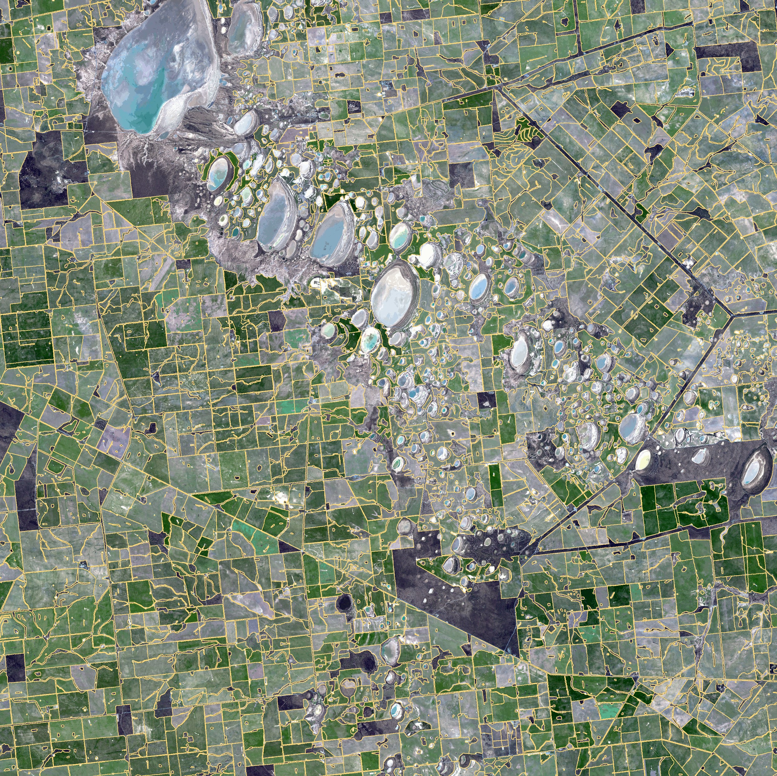
Using artificial intelligence techniques, we’ve been able to map from space around 1.7 million paddocks in Australia’s grain growing region.
Our technology, called ePaddocks™, is highly accurate, detailed and can identify paddock boundaries from season to season. It doesn’t identify a particular property or landowner, or what paddock belongs to whom.
We use publicly available satellite images and apply our deep neural network and algorithms to produce the paddock boundaries based on vegetation signatures and land features. We believe this method will set the standard for similar geo-spatial products.
The ePaddocks™ technology could also be used in other countries and to improve land use maps and track species richness.
ePaddocks™ is available for purchase on CSIRO’s Ag Climate Data Shop
A time consuming obstacle
Digital and satellite services, for example satellite-assisted fertiliser application or crop growth monitoring, can greatly help farmers monitor their paddocks and optimise their use throughout the growing season.
However, farm management software currently requires farmers to manually draw paddock boundaries for every service they use, which is very time consuming. They may have to update this information every growing season.
Unlike property boundaries, which are recorded in local council or title records, paddock boundaries aren’t historically recorded anywhere. A digitised way of determining paddock boundaries has been highly sought after in the digital agriculture world for a while.
Putting paddocks on the map
We’ve now tackled the paddock boundaries problem with new technologies and solved it.
Using artificial intelligence techniques, we’ve been able to map from space around 1.7 million paddocks in Australia’s grain growing region.
Our technology, called ePaddocks™, is highly accurate, detailed and can identify paddock boundaries from season to season. It doesn’t identify a particular property or landowner, or what paddock belongs to whom.
We use publicly available satellite images and apply our deep neural network and algorithms to produce the paddock boundaries based on vegetation signatures and land features. We believe this method will set the standard for similar geo-spatial products.
The ePaddocks™ technology could also be used in other countries and to improve land use maps and track species richness.
ePaddocks™ is available for purchase on CSIRO’s Ag Climate Data Shop
