Assessment aims
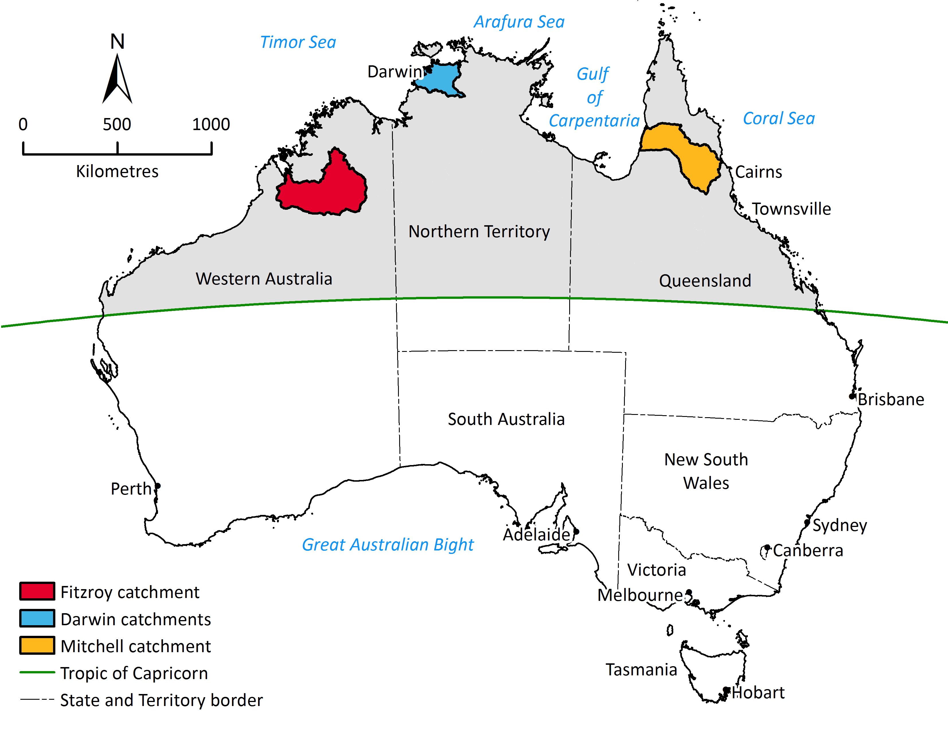
The techniques and approaches used in the Assessment were specifically tailored to the three study areas. However, the novel approaches can be refined and adapted for quickly assessing large areas elsewhere.
For each region, the Assessment:
- evaluated the soil and water resources (both surface and groundwater)
- identified and evaluated water capture and storage options
- identified and tested the commercial viability of irrigated agriculture and aquaculture opportunities
- assessed the potential environmental, social and economic impacts and risks of water resources and irrigation developments.
Why was the Assessment necessary?
Much of northern Australia’s land and water resources have not been mapped in sufficient detail to provide for reliable resource allocation, mitigate investment or environmental risks, or build policy settings that can support decisions.
The Assessment was designed to
- explicitly address the needs of and aspirations for local development by providing an objective assessment of resource availability, with consideration of environmental and cultural issues
- meet the information needs of governments as they assess sustainable and equitable management of public resources, with due consideration of environmental and cultural issues
- address the due diligence requirements of private investors, by exploring questions of profitability and income reliability of agricultural and other developments.
Drawing on the resources of all three tiers of government, the Assessment built on previous studies, drew on existing stores of local knowledge, and employed world-class scientific expertise, with the quality assured through peer-review processes.
The Northern Australia Water Resource Assessment took two and a half years between 16 December 2015 and 30 June 2018.

Key activities
This Assessment was a complex, integrated, multidisciplinary study of vast areas in northern Australia, drawing on capabilities of scientists from across Australia.
Key activities included:
- covering the soil types within the catchment, the distribution of key soil attributes and their general suitability for irrigated agriculture and aquaculture
- outlining the general circulatory systems affecting the catchment and providing information on key climate parameters of relevance to irrigation under current and future climate
- describing and quantifying the surface water and groundwater hydrology of the catchment
- exploring subsurface (i.e. managed aquifer recharge) and surface water storage options and costs
- evaluating a wide range of crops, their water use, yields, and potential returns, explores potential cropping systems and the integration of irrigation into an existing beef enterprise
- assessing the ecological systems and assets of the catchments including the key habitats, key biota and the extent to which they are impacted by changes in streamflow
- assessing current demographics and existing industries and infrastructure of relevance to water resource development and financial analysis of irrigated agriculture and aquaculture
- assessing stakeholder values and potential engagement strategies and the perspectives of potential investors
- assessing Indigenous values, rights, interests, and development objectives: generated through direct participation by Traditional Owners
- assessing the legal, regulatory and policy environment relevant to water-related development.
Assessment aims
The techniques and approaches used in the Assessment were specifically tailored to the three study areas. However, the novel approaches can be refined and adapted for quickly assessing large areas elsewhere.
For each region, the Assessment:
- evaluated the soil and water resources (both surface and groundwater)
- identified and evaluated water capture and storage options
- identified and tested the commercial viability of irrigated agriculture and aquaculture opportunities
- assessed the potential environmental, social and economic impacts and risks of water resources and irrigation developments.
Why was the Assessment necessary?
Much of northern Australia’s land and water resources have not been mapped in sufficient detail to provide for reliable resource allocation, mitigate investment or environmental risks, or build policy settings that can support decisions.
The Assessment was designed to
- explicitly address the needs of and aspirations for local development by providing an objective assessment of resource availability, with consideration of environmental and cultural issues
- meet the information needs of governments as they assess sustainable and equitable management of public resources, with due consideration of environmental and cultural issues
- address the due diligence requirements of private investors, by exploring questions of profitability and income reliability of agricultural and other developments.
Drawing on the resources of all three tiers of government, the Assessment built on previous studies, drew on existing stores of local knowledge, and employed world-class scientific expertise, with the quality assured through peer-review processes.
The Northern Australia Water Resource Assessment took two and a half years between 16 December 2015 and 30 June 2018.
Key activities
This Assessment was a complex, integrated, multidisciplinary study of vast areas in northern Australia, drawing on capabilities of scientists from across Australia.
Key activities included:
- covering the soil types within the catchment, the distribution of key soil attributes and their general suitability for irrigated agriculture and aquaculture
- outlining the general circulatory systems affecting the catchment and providing information on key climate parameters of relevance to irrigation under current and future climate
- describing and quantifying the surface water and groundwater hydrology of the catchment
- exploring subsurface (i.e. managed aquifer recharge) and surface water storage options and costs
- evaluating a wide range of crops, their water use, yields, and potential returns, explores potential cropping systems and the integration of irrigation into an existing beef enterprise
- assessing the ecological systems and assets of the catchments including the key habitats, key biota and the extent to which they are impacted by changes in streamflow
- assessing current demographics and existing industries and infrastructure of relevance to water resource development and financial analysis of irrigated agriculture and aquaculture
- assessing stakeholder values and potential engagement strategies and the perspectives of potential investors
- assessing Indigenous values, rights, interests, and development objectives: generated through direct participation by Traditional Owners
- assessing the legal, regulatory and policy environment relevant to water-related development.
