There are opportunities to unlock significant new investments in the north. This requires confidence about the scale and nature of the opportunities and understanding of the risks involved.
Millions of hectares of soil are potentially suitable for irrigated agriculture across northern Australia. But access to water is one of several constraints to development.
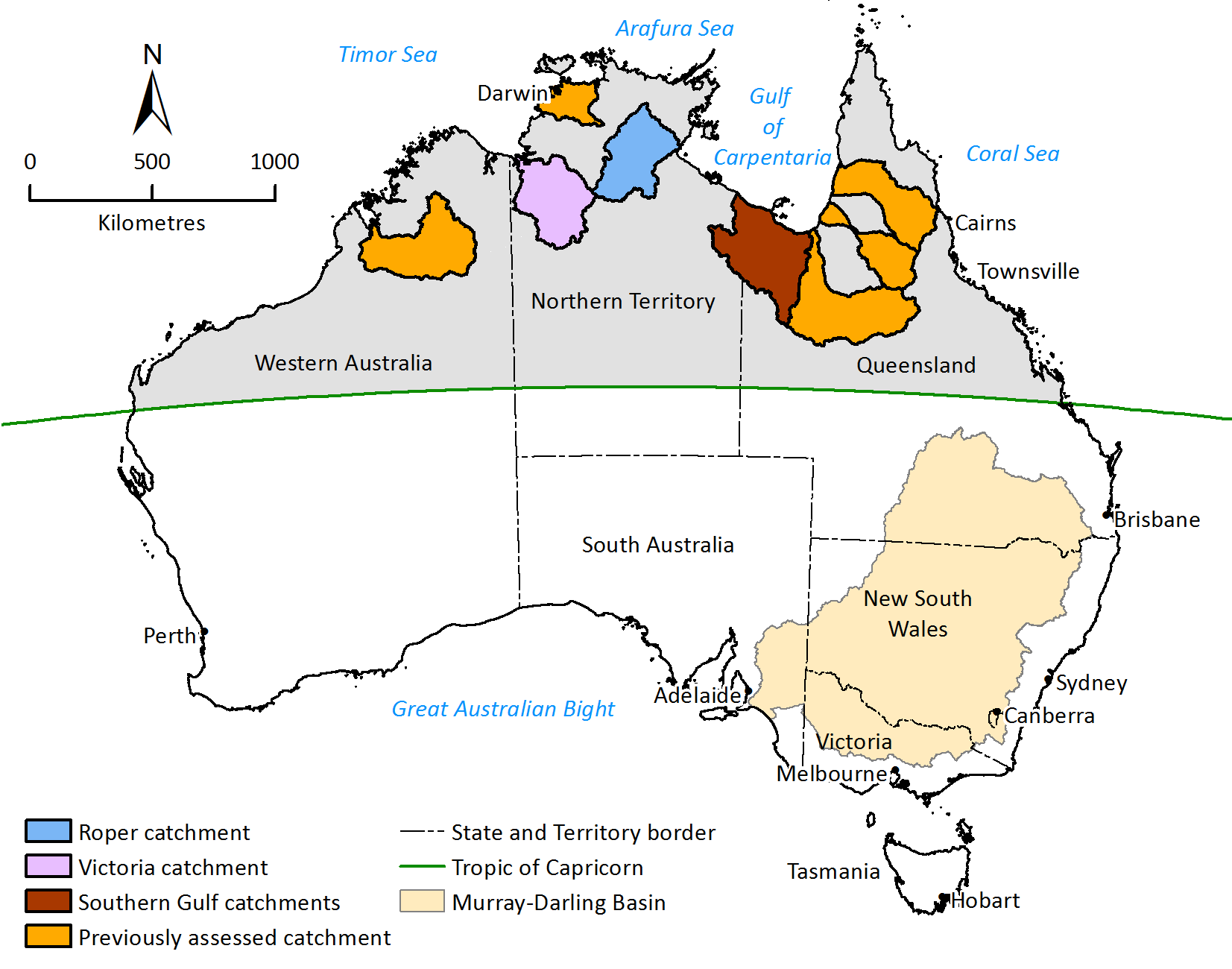
CSIRO was engaged by the Australian Government to assess the opportunities for water and agricultural development in the Victoria River catchment in the Northern Territory.
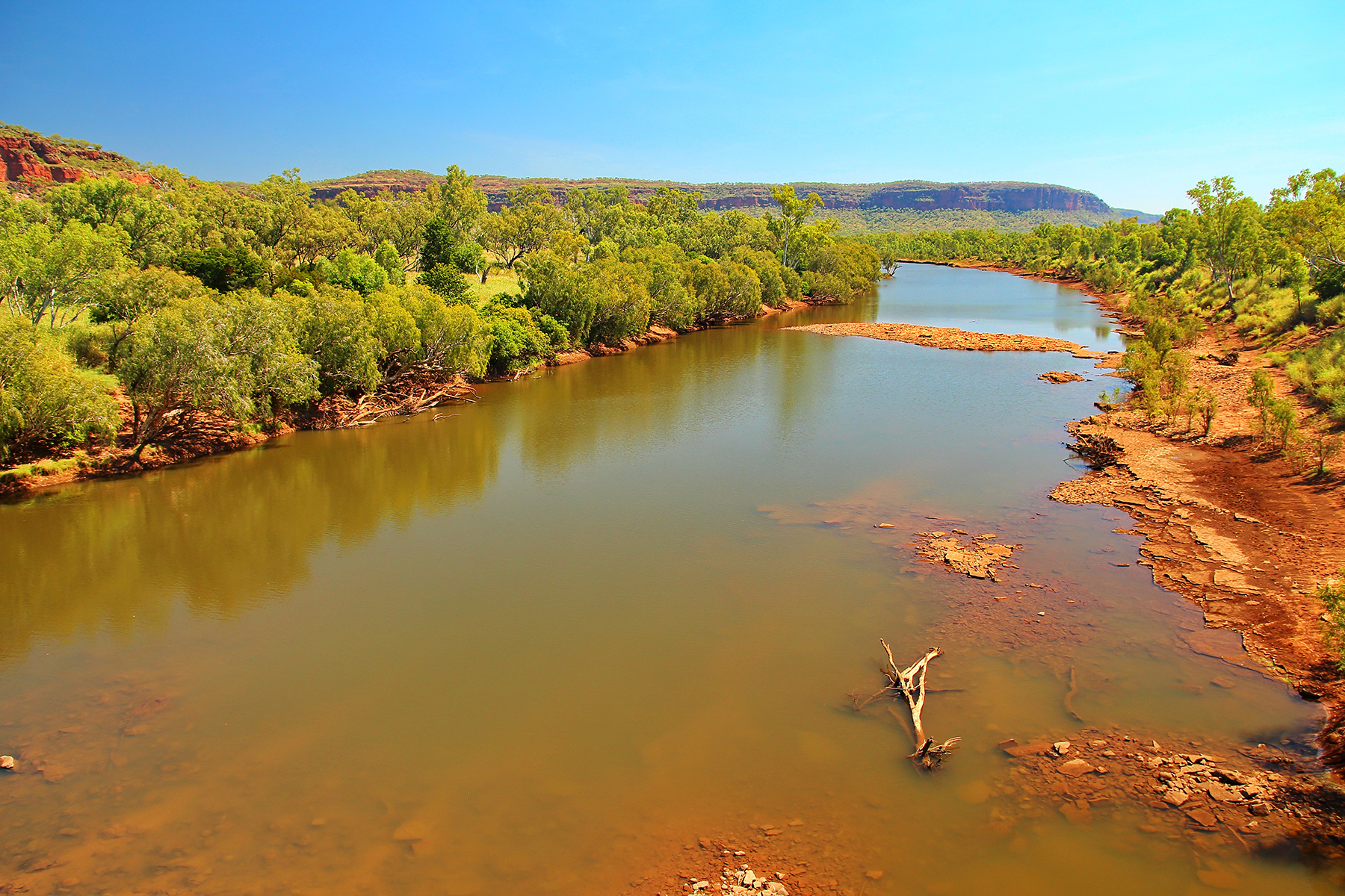
Following our successful work on the Flinders and Gilbert Agricultural Resource Assessment, the Northern Australia Water Resource Assessment, and the Roper River Water Resource Assessment, we were engaged by the Australian Government to assess the opportunities for water and agricultural development in the Victoria River catchment in the Northern Territory.
We worked together with the Northern Territory government, research partners and communities to complete this assessment in 2024. Our findings are all publicly available.
Assessment goals
Through the Victoria River Water Resource Assessment we provided a comprehensive and integrated evaluation of the feasibility, economic viability and sustainability of water and agricultural development in the Victoria River catchment in the northern Territory.
In doing so, we:
- evaluated soil and water resources
- quantified the scale of available surface and groundwater resources
- identified and evaluated water capture and storage options
- identified and tested the commercial viability of irrigated agriculture and aquaculture opportunities
- assessed potential environmental, social and economic impacts and risks of water resource and irrigation development.
While agricultural developments may be the most likely to proceed in the foreseeable future, the Assessment also considered opportunities for, and intersections between, different types of potential water-dependent development.
Assessment activities
This complex project drew on the capabilities of scientists from across Australia.
The team's key activities included:
- Surface water modelling to assess the volume and reliability of river flow
- Characterising, mapping and quantifying groundwater resources
- Topographic mapping and automated terrain analysis to identify and evaluate water storage and development options
- Mapping land and soil suitability and production risks for agriculture and aquaculture developments
- Assessing cropping and crop–forage–livestock systems with potential to generate attractive investment returns
- Cost-benefit analyses for multiple uses and users of water
- Identifying logistical and value chain assets, opportunities and bottlenecks
- Understanding the trade-offs between water resource development and freshwater dependent marine and freshwater species and habitats
- Identifying Indigenous peoples' aspirations and water values
- Examining the potential for co-benefits to other industries arising from irrigated agriculture
- Information and data distribution through web-based information products, reports, and community-based information sessions.
The Victoria River Water Resource Assessment was funded through the Australian Government’s National Water Grid Science Program.
There are opportunities to unlock significant new investments in the north. This requires confidence about the scale and nature of the opportunities and understanding of the risks involved.
Millions of hectares of soil are potentially suitable for irrigated agriculture across northern Australia. But access to water is one of several constraints to development.
CSIRO was engaged by the Australian Government to assess the opportunities for water and agricultural development in the Victoria River catchment in the Northern Territory.
Following our successful work on the Flinders and Gilbert Agricultural Resource Assessment, the Northern Australia Water Resource Assessment, and the Roper River Water Resource Assessment, we were engaged by the Australian Government to assess the opportunities for water and agricultural development in the Victoria River catchment in the Northern Territory.
We worked together with the Northern Territory government, research partners and communities to complete this assessment in 2024. Our findings are all publicly available.
Assessment goals
Through the Victoria River Water Resource Assessment we provided a comprehensive and integrated evaluation of the feasibility, economic viability and sustainability of water and agricultural development in the Victoria River catchment in the northern Territory.
In doing so, we:
- evaluated soil and water resources
- quantified the scale of available surface and groundwater resources
- identified and evaluated water capture and storage options
- identified and tested the commercial viability of irrigated agriculture and aquaculture opportunities
- assessed potential environmental, social and economic impacts and risks of water resource and irrigation development.
While agricultural developments may be the most likely to proceed in the foreseeable future, the Assessment also considered opportunities for, and intersections between, different types of potential water-dependent development.
Assessment activities
This complex project drew on the capabilities of scientists from across Australia.
The team's key activities included:
- Surface water modelling to assess the volume and reliability of river flow
- Characterising, mapping and quantifying groundwater resources
- Topographic mapping and automated terrain analysis to identify and evaluate water storage and development options
- Mapping land and soil suitability and production risks for agriculture and aquaculture developments
- Assessing cropping and crop–forage–livestock systems with potential to generate attractive investment returns
- Cost-benefit analyses for multiple uses and users of water
- Identifying logistical and value chain assets, opportunities and bottlenecks
- Understanding the trade-offs between water resource development and freshwater dependent marine and freshwater species and habitats
- Identifying Indigenous peoples' aspirations and water values
- Examining the potential for co-benefits to other industries arising from irrigated agriculture
- Information and data distribution through web-based information products, reports, and community-based information sessions.
The Victoria River Water Resource Assessment was funded through the Australian Government’s National Water Grid Science Program.