CSIRO has completed, for the Government of Western Australia and industry partners, an overview of the current and future climate and water resources of the Pilbara to aid water planning and management. These resources included regional surface water, groundwater and environmental water, and allowed local studies to be placed into a regional context.
The Assessment was funded by a $0.5 million contribution from BHP Billiton and $1.5 million each from CSIRO and the Government of Western Australia through the Royalties for Regions program. The research project was led by CSIRO and overseen by officers from the Department of Water, BHP Billiton, the Pilbara Development Commission and the Water Corporation.
The Assessment area
The Pilbara Water Resource Assessment covers an area of 288,479 km2, which is about 11 per cent of the state of Western Australia. This is one of the world's most important resource regions for high-grade iron ore deposits and offshore gas reserves. Irrigated agriculture may also expand to augment the area's long-term grazing industries.
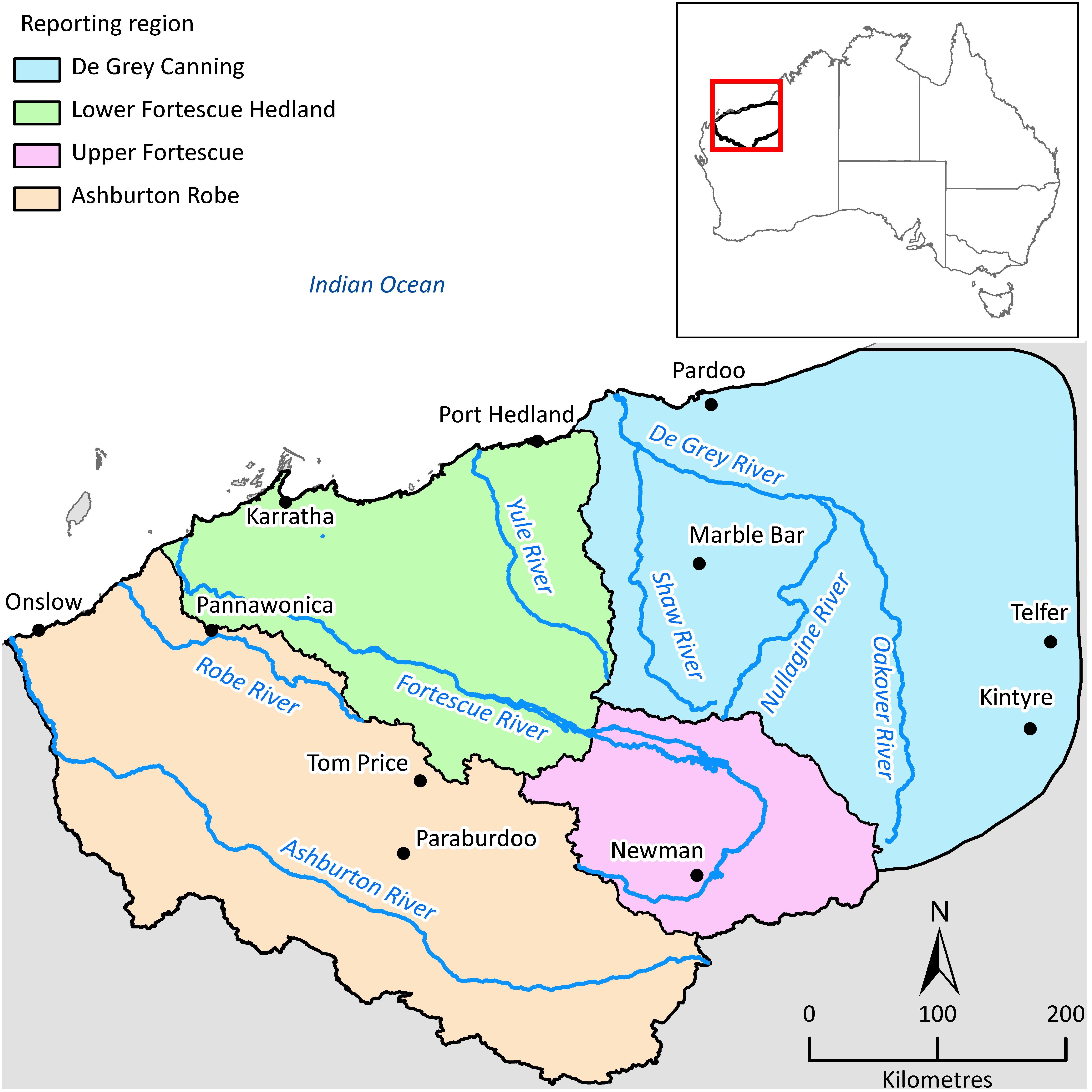
The Assessment examined surface water and groundwater resources and their environmental significance in detail for four regions within the Assessment area: Ashburton Robe, Upper Fortescue, Lower Fortescue Hedland and De Grey Canning (see map below).
The reporting regions for the Pilbara Water Resource Assessment: Ashburton Robe, Upper Fortescue, Lower Fortescue Hedland and De Grey Canning.
