[Aerial view of the ocean appears on screen, with text: Mysteries of the Leeuwin]
Narrator: The mystery and power of the oceans have always attracted human curiosity.
[Image changes to an underwater shot of a reef rock, then changes to a three masted ship sailing on the ocean]
Perhaps it’s an instinctive response, a recognition that the sea is the primeval origin of life. For thousands of years people have been venturing into the oceans in pursuit of empire, fortune or simply to find out what’s there.
[Image changes to an old map of Australia, then changes to a painting of an old sailing ship]
Our knowledge of the sea, its currents and moods has been built up and passed from one generation of mariners to the next through a lot of trial and a lot of error.
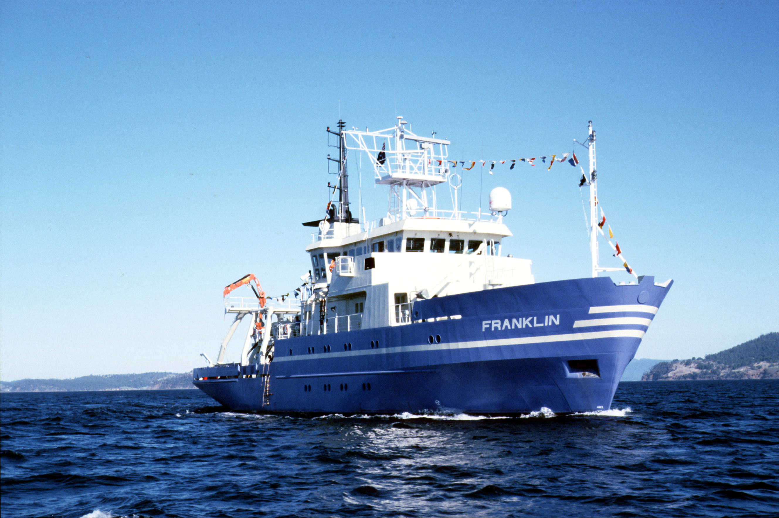
[Image changes to an old rusted shipwreck and then to the research vessel Franklin cruising through the ocean]
But now a new generation of explorers is taking much of the guesswork and hazard out of our understanding of the oceans.
[Image changes to Dr George Creswell CSIRO, Hobart]
Dr George Cresswell I guess that scientists are attracted to the sea because it’s physically and it’s intellectually tough to get your information to try and work out what’s going on.
[Image changes to oceanographers working on a map and then to a shot of the ocean from a ship]
Narrator: For oceanographers the process of scientific discovery has traditionally depended on patient observation often over long periods of time and vast distances.
[Image changes to a man operating ship controls and them to a satellite dish and a woman working on a computer]
But now new technology has come to the rescue and the immense scale of the oceans has been reduced to a more manageable form.
[Image changes to a computer animation showing ocean temperatures and currents around Australia then changes back to Dr George Cresswell]
Dr George Cresswell I think you’ve got to understand that oceanographers have been limited by their instrumentation and it’s only in the past ten or 15 years that we’ve got, for example,
[Image changes to a man working on a computer, a buoy floating in the ocean and a ship mounted radar unit rotating then back to Dr George Cresswell] satellite imagery, satellite track buoys, the capability of measuring currents from our research vessel and these things mean that we can tackle problems and we can find things that weren’t known to exist before.
[Image changes to a printer plotting ocean currents then to a younger Dr Cresswell removing the printed paper]
Narrator: For more than two decades Dr George Cresswell and his fellow marine scientists in the CSIRO have been probing the mysteries of the oceans that surround Australia.
[Image changes to Dr Cresswell and Carl attaching a chain to a buoy]
Dr George Cresswell: Righto well there we are. We think that that’ll hold it for a year or two, Carl.
Carl: I reckon.
Narrator: In the early 1970s they designed and built the first ocean buoys whose movements could be tracked by satellite.
Dr George Cresswell Yeah, well that’s what we’re hoping for. We want the buoy system to last for a couple of years and chafing’s one of our main problems.
[Image changes to show three men carrying a buoy across the rear deck of a ship]
Narrator: On a series of cruises off the coast of Western Australia they launched the buoys into what was originally believed to be a north flowing ocean current.
[Image changes to the buoy being launched from the back of the ship and splashing into the ocean]
[Image changes to a person feeding paper cards into a machine then to a computer image of Cape Leeuwin on a computer screen with lines appearing in different colours]
When they analysed the complicated series of tracks detected by satellite they found instead a pattern of southward movement down the coast and around Cape Leeuwin.
[Image changes to an old sailing ship on the ocean and then changes to close up shots of the ship]
The Cape was named after a Dutch vessel, which first sighted the west coast of Australia over 360 years ago. The Leeuwin or Lioness was the first vessel to venture around the Cape and into the Great Australian Bight. Cresswell and his colleagues thought it appropriate that the current revealed by the drifting buoys be called the Leeuwin Current.
[Image changes back to Dr Cresswell]
Dr George Cresswell: The Leeuwin Current essentially flows the wrong way for a current on the eastern side of an ocean. It flows into pretty strong prevailing winds.
[Image changes to an aerial shot of vast sand dunes meeting the ocean]
It brings warm water from the tropics down to Cape Leeuwin and then across the Great Australian Bight. For us physical oceanographers it’s exciting because it’s strong. It’s locked to the continental shelf edge more or less as if it’s running on a rail. It has breakouts to sea where it forms eddies and offshoots.
[Image changes back to Dr Cresswell]
All of these things excite us because they’re complex and difficult to study but they’re very important in the national interest, fisheries, defence, things like that.
[Image changes to an aerial shot of ocean surf then to shots of islands in the ocean]
Narrator: But these researchers weren’t the first to suspect the existence of a mysterious warm current in these parts. In the 1890s the Abrolhos Islands off the coast of Geraldton had been visited by the British naturalist William Saville-Kent.
[Image changes to the book cover of THE NATURALIST IN AUSTRALIA then changes to views of pages from the book showing photos of coral a newer book with photos and illustrations of coral]
Saville-Kent recorded his impressions in a lavishly illustrated book. He was fascinated by the unique flora and fauna he found on the Abrolhos. He wrote of the very remarkable interblending of both tropical and temperate marine organisms there and concluded that but one interpretation seems possible.
[Image changes to illustrations of different starfish laid out, then to an old photo portrait of Saville Kent from the book]
An ocean current setting in from the equatorial area of the Indian Ocean penetrates as far south as this island group.
[Image changes to a black and white photo of an exposed reef and then to a shot of the research vessel Franklin in the ocean]
Saville Kent’s theory was not to be proved correct for another 80 years because it’s only in recent times that techniques have become available to accurately follow the current’s narrow, seasonal and erratic path.
[Image changes to an animated world map with moving white lines indicating the directions of currents in the world’s oceans]
On a global scale the ocean currents form giant eddies which run clockwise in the northern hemisphere and anti-clockwise in the south. This carries cold water along the west coasts of all the continents, for example, the cold north flowing Humboldt Current off the west coast of South America and the cold Benguela Current off the west coast of southern Africa. But off the west coast of Australia things are different. The Leeuwin runs against the prevailing flow actually accelerating into the driving winds at speeds up to a metre a second. In the process it has a significant effect on weather and marine life and this is why it’s so fascinating to scientists.
[Image changes to Alan Pearce CSIRO, Marmion, WA]
Alan Pearce: Satellite imagery is an extremely valuable tool in studying ocean currents like the Leeuwin Current which are so much warmer than the water around them and here in Western Australia we’re extremely lucky in having an archive of some five years of satellite images of the waters off Western Australia and we’re using these in the study of the climatology of the Leeuwin Current in which we’re looking for the waxing and waning of the Leeuwin Current seasonally and possibly effects like El Niño which happens every few years.
[Image changes to a satellite image of sea surface temperature on a computer screen]
This image that we have here was taken in June 1984 and shows the Leeuwin Current in full flight. On the right we have the land with Shark Bay up in the north, Cape Leeuwin down here and Perth about here. This is cloud offshore and the Leeuwin Current is the band of warm water shown in red which streams down the coast. We’re interested in this, what appears to be an onshore flow in this region is clearly a jet down the shelf break south of Geraldton and then it meanders offshore, swings back in towards the coast off Perth and then continues southwards past Cape Leeuwin and one of the unique features about the Leeuwin Current is that it then seems to turn left at Cape Leeuwin and heads off towards the Great Australian Bight and we know that in some years it gets as far as Tasmania too.
[Image changes to an aerial shot of farmland and then to massive sand dunes meeting the ocean]
[Image changes to show the ship Franklin cruising through the ocean]
Narrator: If it weren’t for the Leeuwin Current the lush southwest of Australia would be denied much of its winter rain. It could perhaps even be a desert like the corresponding areas of South America and South Africa but in the warm waters of the Leeuwin there are no vast populations of fish such as anchovies and sardines nurtured by cold nutrient-rich currents.
[Image changes to an underwater shot of coral and then to an aerial shot of an island then back to an underwater shot of a coral reef]
Instead there are scenes more reminiscent of the tropics. The Abrolhos Islands support among the most southerly coral formations in the world. They are as splendid and rich in life as any on the Great Barrier Reef yet despite this apparent abundance these waters yield little of value to commercial fishermen with the spectacular exception of one remarkable species.
[Image changes to two men emptying bags of lobster into a metal container, then to people boiling, sorting and stacking lobsters in a big pile at a processing plant]
The western rock lobster has become by far Australia’s richest export fishery worth around $150 million a year. The tails will find their way to the tables of New York and there is a growing market for live lobsters which are destined for the restaurants of Japan.
[Image changes to people putting lobsters into Styrofoam boxes and covering them with wood shavings and then changes to a boat powering through the waters off Rottnest Island]
The western rock lobster, Panulirus cygnus, is uniquely adapted to the vagaries of the Leeuwin Current.
[Image changes to show a man grappling a buoy and pulling in a lobster pot onto the boat]
Researchers from the Western Australian Fisheries Department and CSIRO Marine Laboratories are collaborating on major research programs to study its life cycle, ecology and behaviour. [Image changes to Dr Chris Chubb W.A. Dept. of Fisheries] Dr Chris Chubb: We’re tagging rock lobsters in an attempt to follow individual breeding females through their life cycle basically in an attempt to find out how many times they spawn in a year. Previously it was thought it was once a year but my research so far has shown that the majority of the population spawn twice a year.
[Image changes to three men measuring and inspecting lobsters]
Man: One hundred and thirteen point eight male.
Dr Chris Chubb: We tag most of the animals that come out of the pots and we gain additional information on the biology such as growth information and information on movements when rock lobster fishermen pick them up later on in the season.
[Image changes to show two men in an office inspecting and taking measurements of a lobster]
Man: One hundred and seven point zero.
Dr Chris Chubb: During the mating process the male deposits a spermatophore or what’s commonly called the tar spot on the sternum of the female. When the female is then ready to lay eggs she assumes a position on the seabed floor where she tucks her tail underneath her and the pleopods that you can see here rhythmically beat to create a current which draws water back into this brood pouch which has been formed. The eggs are then extruded through these ovipores on the third pair of the walking legs there. The spermatophore or tar spot has been scratched by the walking legs so the eggs and the spermatozoa are drawn back into the brood pouch and fertilisation occurs. The fecundity or number of eggs in a brood ranges obviously with size but ranges somewhere between about 100,000 and 900,000 eggs with an average around about 200,000 to 500,000.
[Image changes to microscopic views of lobster larvae]
Narrator: The newly hatched larvae or phyllosome are almost transparent, barely visible to the eye. They go through repeated moultings finally reaching about 35 millimetres in length after about a year and it’s during this stage that they undertake an extraordinary journey thanks again to the Leeuwin Current.
[Image changes to an aerial shot of an Island and then changes to a satellite image of sea surface temperature on a computer screen which is being inspected by a scientist]
On its long journey south the warm waters of the Leeuwin sometimes develop breakouts to sea which eventually swing back again to the shore. It’s now thought that meanders of the current like this are a major mechanism by which the lobster larvae are carried out to sea and eventually returned to the safety of the coastal reefs.
[Image changes to an aerial shot of an Island, then changes to juvenile lobsters in the palm of a person’s hand and then changes to underwater views of adult lobsters]
Here they settle in their final planktonic stage known as the pirillus ready to moult into juvenile miniatures of the adult lobster and it’s here in the limestone reefs and lagoons at Seven Mile Beach near Geraldton that CSIRO has been carrying out what must surely be the longest running study of any sea animals in Australia.
[Image changes show two men in a dinghy hauling up lobster pots and inspecting and taking measurements of the lobsters]
Man: OK Dave. Dave: Male, two legs, red.
Man: Two legs?
Dave: Yeah, two legs missing that is, 64.8.
Man: OK.
Dave: No Ls, no Rs.
Man: Right.
[Image changes to Dr Sebastian Rainer, CSIRO, Marmion, W.A.]
Dr Sebastian Rainer: Well there are in fact several programs here but the longest running one that we have is one that started in 1967 looking at the settlement of young rock lobsters in this area.
[Image changes to show a man pulling a lobster collector into a dinghy and shaking it over a plastic tub]
Narrator: These collectors made of artificial seaweed have proved to be an ideal refuge for the infant lobsters. By regularly checking the collectors scientists are able to get a reliable index of the numbers of pirillus that have settled on the reefs. This in turn indicates the numbers of lobsters, which can safely be harvested in four years time when they have reached the legal catching size.
[Image changes to a man on a commercial lobster boat measuring caught lobsters and throwing back the small ones]
[Image has changed to show a diver inspecting a cage on the sea floor then shows lobster walking around inside the cage]
Other research programs involve analysing the feeding behaviour of the juvenile lobsters. Core samples are taken from the seabed and an ingenious vacuum airlift collects materials from the weed beds. Cages are used to keep the lobsters either in or out of an area to see what difference they make to the density of food. The idea of the program is to determine the conditions and nutrients which give optimum growth rates to the young lobsters.
[Image changes to show a diver with a pipe in his hands vacuuming the weed bed at the bottom of the ocean and then changes to a diver inspecting a cage]
[Image has changed to show a man on a beach examining the samples from the sea floor vacuum and core samples]
[Image changes to show two men on a dinghy gluing tracking devices to lobsters and releasing them into the water]
But perhaps the most intriguing line of research is a program to determine the foraging habits of lobsters. How far will a lobster go to get a feed? Does it have territorial limits? There seemed only one way to find out. That was to place small electromagnetic tags onto the lobsters’ backs.
[Image changes to an illustration of the sea floor with a grid laid over the top and then changes to underwater views of lobsters with tracking devices moving around the sea floor, lines then appear on the map indicating the lobster’s movements]
With a receiving wire grid laid out across the sea floor the lobster’s nocturnal haunts are revealed. The study has found they stay out all night, often follow set foraging paths and can travel up to 800 metres in a single night but the waters of the Leeuwin hold even greater secrets than these. [Image changes to an aerial shot of Islands and then changes to fish swimming around coral]
A chain of reefs stretches for over 2000 kilometres off the western border of the continent from the fringing Ningaloo track in the north to the temperate water of the southwest and here on one night of the year can be seen one of nature’s most spectacular displays, the breeding of coral.
[Image changes to a close up shot of coral with tiny spores being released]
Normally there is no coral off the western coasts of continents because the water is too cold but the warm Leeuwin starts to flow in autumn and that’s when the corals begin to breed.
[Image changes to Dr Simpson]
Dr Chris Simpson: The amazing thing about the coral spawning is that it occurs at a very predictable time each year and we’ve been able to predict the exact time within about five minutes in the past few years on tropical reefs in Western Australia.
[Image changes back to a close up of the coral releasing spores]
But certainly the amazing thing is that… and it’s unique in the biological world that many different species of corals are all spawning at the same time.
[Image changes to a woman looking through a microscope inspecting a tuna larvae and then changes to a tuna being caught on a fishing line]
Narrator: And it’s not just the coral larvae that hitch a ride with the Leeuwin. These tiny creatures have been plucked from the ocean hundreds of kilometres off the northwest coast. They might look like small fry. In fact they are the larvae of one of our most important commercial fish, the southern bluefin tuna.
[Image changes to a man looking through a microscope and then inspecting the sample on a video monitor]
Very little is known about the early life history of the tuna although by studying the biology of the larvae and doing some clever scientific detective work a surprising amount can be deduced.
[Image changes to a microscope view of a larval tuna ear bone on the video screen]
This is the ear bone of the larval tuna, the only bone which is calcified at this stage. The dark and light lines are due to a daily cycle of calcium metabolism so each pair represents one day thus it’s possible to age the larva and calculate the spawning date of its adult parent.
[Image changes to a world map with a grid laid over the top and a person pointing to a section on the map]
Catching the tuna larvae is a case of literally finding a speck in the ocean. Japanese researchers have been looking for the larvae all over the world and have found them in the same area that is thought to provide the source water for the Leeuwin Current.
[Image changes to John Hampton CSIRO, Hobart]
John Hampton: The southern bluefin tuna spawn in a fairly large area south of Indonesia. As juvenile fish whilst they’re probably active swimming at that stage they’re probably helped in their southerly migration by the Leeuwin Current and helped contained close to the Australian coast by the Leeuwin Current.
[Image changes to an animated map of Australia with the Leeuwin Current shown in white]
Narrator: When they reach the corner of Western Australia a large number of the developing tuna follow the current into the Great Australian Bight. Here they become the target of the Australian tuna fishery.
[Image changes to a trawler cruising on the ocean and then changes to fishermen hauling tuna onto the trawler]
These fish are destined to wind up on the supermarket shelf as food for both people and cats.
But for the Japanese tuna are a different kettle of fish altogether.
[Image changes to a large Japanese ship docked at a port and then to a world map]
Japanese boats pursue the bigger tuna using lines up to 80 kilometres in length in the deep southern waters between Africa and New Zealand and in the sashimi restaurants of Tokyo they’re a prized delicacy indeed.
[Image changes to a Sashimi chef preparing a piece of tuna]
Sashimi preparation is an art form. The end product eaten raw bears little resemblance in appearance or taste to the stuff of an Aussie tuna sandwich. The difference is reflected in the relative value of the fish. The average tuna caught by the Australian fishery is worth about $10 but a good quality carefully handled fish caught for the Japanese market can be worth $1000 or more. It’s not surprising that the Australian industry is starting to look to the sashimi market.
[Image changes to the research vessel Franklin at sea]
The implications of the Leeuwin are obviously far reaching and are covered by several scientific disciplines so throughout this year CSIRO has been conducting a major research program called Project LUCIE.
[Image changes to Dr Cresswell on board Franklin]
Dr George Cresswell: LUCIE, it stands for the Leeuwin Current Interdisciplinary Experiment and it’s the major piece of work that the Division of Oceanography of CSIRO is going to do this year.
[Image changes to a man working on samples in a laboratory on the ship then back to Dr Cresswell]
Most of our scientists are tied up in LUCIE and we’re using Franklin to collect most of the information on the currents. We want to know its temperatures, its salinities, the nutrients in it and the way the currents vary through it. Well to give you some idea of the scale of this operation we’ve got about 70 people in the Division of Oceanography. Probably three-quarters of them are tied up with either being on the ship at different times or running the experiment from back in Hobart.
[Image changes to the RV Franklin cruising through the ocean, then to a radar spinning on the ship, then back to Dr Cresswell]
Well Franklin’s two years old. It’s a modern, very well equipped ship. It’s as good as any in the world. It’s got a variety of excellent equipment onboard. For example, it can measure currents as the ship’s going along.
[Image changes to show two men working on sonar equipment and taking notes and then shows a monitor with a graph on it]
It sends down some sonar beams and it can profile temperature and salinity and other properties to the bottom of the ocean.
[Image changes show two men moving a large piece of equipment on an overhead rail then using a crane to put the equipment into the ocean]
The CTD, it stands for Conductivity, Temperature and Depth Profiler. It measures conductivity and from that we can calculate salinity and temperature, which I’ve just measured. It also measures oxygen and that’s what we oceanographers need to get an understanding of the ocean’s properties and work out where it’s going and where the water’s coming from.
[Image changes to an underwater shot of a reef with fish swimming around]
Narrator: Where the Leeuwin waters come from is still something of a mystery but it is known that high sea level and persistent trade winds force a volume of warm water from the Pacific through the Indonesian Islands into the Indian Ocean raising the sea level and from there the water literally runs downhill along the Western Australian coast.
[Image changes to a buoy being launched into the ocean and then to a computer image of Cape Leeuwin with lines appearing indicating the movement of the buoys]
Drifting buoys are used to follow the current’s movements. Their position is relayed via satellite to Hobart where computers translate the signals into images.
[Image changes to a shot of the ocean with lots of seagulls bobbing on the surface]
Occasionally there is an oceanographic front, a confluence of cold water with warm arms of the Leeuwin and when this occurs there is a bloom of tiny marine organisms which once again bring the fish and the birds.
[Image changes to dolphins swimming in front of a ship and then to the Bunyip being assembled and being lowered into the water by a crane]
Even the dolphins turn up to join in the feast. At times like this an ingenious and sophisticated instrument called the Bunyip comes into its own. The rocket shaped buoy is towed behind the Franklin sometimes throughout the night.
[Image changes to two men inspecting the steering vehicle and lowering it from the back of the ship by crane]
The Bunyip is steered by the small winged vehicle, which can fly it wherever the shipboard scientists want it to go.
[Image changes to Dr Trevor McDougall CSIRO, Hobart]
Dr Trevor McDougall: We’ve developed Bunyip here to take a lot of vertical profiles in the ocean. We do this by towing the two vehicles and the first vehicle has wings that rotate and we can control the wings from here, from this computer.
[Image changes to a computer monitor showing the towed vehicle’s path through the sea]
And here we have the wing angle at 13 degrees displayed on this little diagram and the pitch of the vehicle at 10 degrees which says that the vehicle is trying to go up this sawtooth shape here decreasing its depth. And then in the top of the screen we have the depth of the first vehicle and the tension on the cables is 10% and 7% of breaking strain of the cable.
[Image changes back to Dr McDougall]
The first vehicle is just there to provide the depth variability of the wings and the second vehicle is an aerodynamically smooth torpedo-shaped vehicle and it measures the mean properties with a resolution of a metre or so and also measures the turbulence properties down to a scale of a centimetre and from these very small scale features we can deduce the amount of mixing in the ocean.
[Image changes to the computer monitor showing the diagram of the vehicle’s path through the water then to the back deck of a ship with people working on some equipment]
Dr George Cresswell: We’ve been collecting current data from the surface down on to 400 metres. We’ve been getting that every few minutes.
[Image changes to show three men inspecting monitors and graphs]
We’ve been getting surface salinity and temperature. We’ve been dropping expendable temperature probes that drop down 700 metres and give us the temperature structure. We’ve also been getting the fluorescence or the amount of phytoplankton in the water.
[Image changes to Dr Cresswell]
OK, it’s five o’clock in the morning. We’ve had a pretty interesting night. We’ve been way out to sea and then we’ve come back in again. Now we’ve come across a cyclonic or a cold eddy. This eddy’s being spun up by the Leeuwin Current. Right now we’re sitting in a three knot current and you can probably feel the ship shaking around a little bit. We think that that three knot current when it spins up the eddy it’s contributing to the enrichment of the water that you saw earlier today with those porpoises and the birds, etcetera.
[Image changes to a man at a chart table recording information]
We’ve collected a lot tonight and we’re going for three weeks on this cruise.
[Image changes to an aerial view of the ship Franklin at sea]
Narrator: The data collected on this and similar cruises will provide a vast amount of information most of which will be processed at CSIRO’s Marine Laboratories in Hobart.
[Image changes to a satellite dish and then to an aerial view of the CSIRO Marine Laboratories in Hobart on the edge of the Derwent River, with the Franklin moored at the dock beside them]
It’s a measure of its importance to both our weather and marine life that such technological and human resources have been dedicated to understanding the Leeuwin.
[Credits roll: acknowledgements, John Izzard, Kevin Healey, Dongara Lobster Processors, Kuni’s Restaurant, South Australian Film Corporation, Western Australian Maritime Museum – narration, Andrew Waterworth – script & production, Russell Porter – cinematography, Roger Seccombe ACS – sound recording & editing, Robert Kerton – editing, Peter Carrodus – animation, John Taylor – direction, Russell Porter, Roger Seccombe – executive producer, Nick Alexander – ©1988 CSIRO Australia]