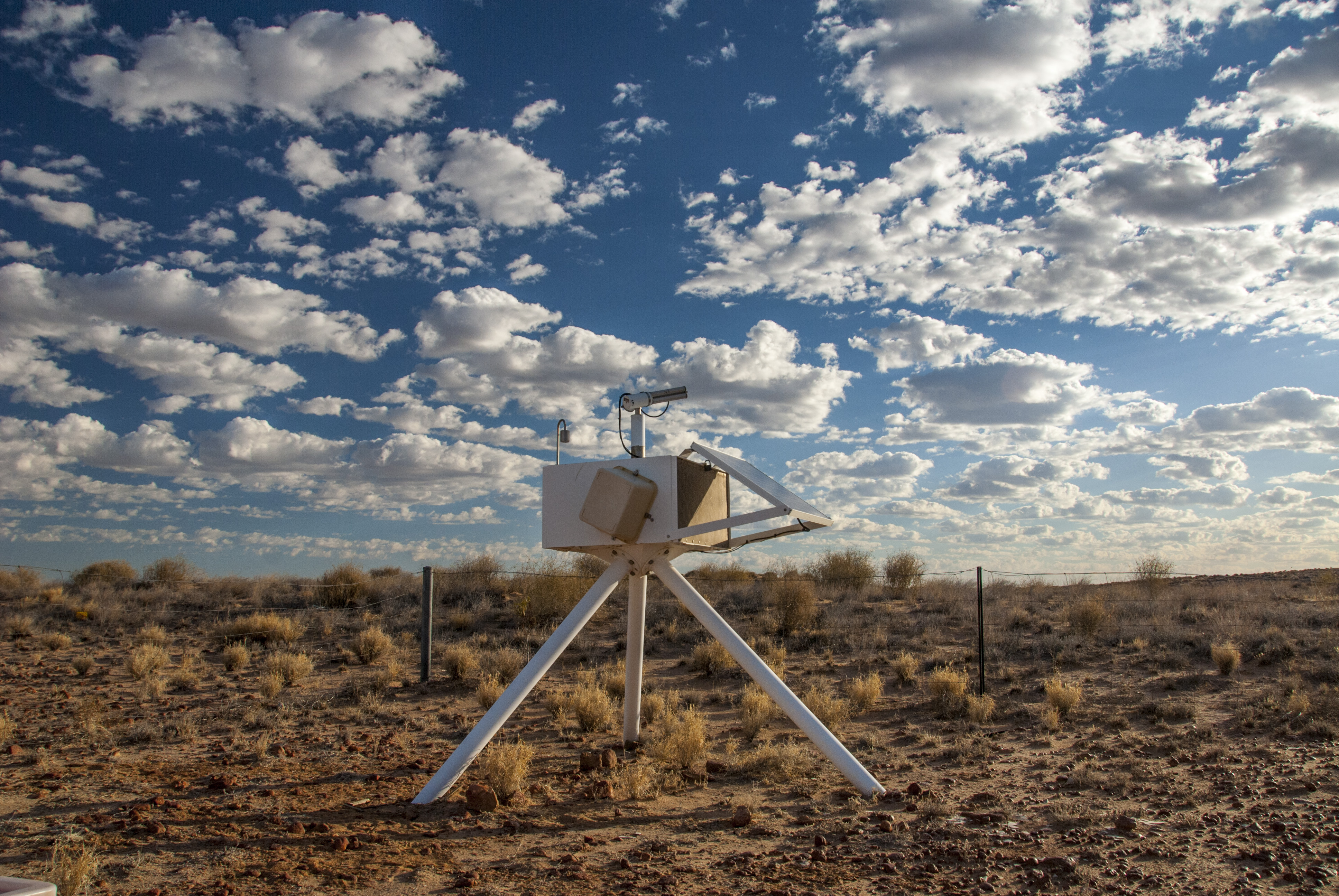
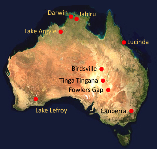
 In 1997, the first Aerospan station was installed in the remote Strzelecki desert of South Australia. Further stations were established over subsequent years at targeted locations. For many stations, the data record now exceeds 10 years, allowing generation of aerosol climatologies for both the tropical north and the arid zone.
The role of aerosol in moderating climate change is well recognised, both through the scattering and absorption of incoming solar radiation by aerosol (the so-called direct effect) and via the modification of cloud droplet size and cloud lifetime (the indirect effect). In the past, uncertainty as to the magnitude of these effects stemmed largely from the lack of a comprehensive knowledge of regional and seasonal characteristics of aerosol across the globe.
Sun photometer networks, such as the Aerosol Robotic Network (AERONET) operated by NASA GSFC, were established in the 1990s to address that need. At that time, little attention had been focused on the characterisation of Australian continental aerosol, even though Australia is a globally significant source of biomass burning aerosol, contributing about 10 per cent of global emissions, largely from seasonal savanna burning in the tropical north.
In addition, the Australian deserts are well known as sources of wind-blown dust, and constitute the largest dust source in the Southern Hemisphere. Although distant from most major aerosol sources in the Northern Hemisphere, it is clear that Australia is the recipient of long-range transport of aerosol from external sources, for example biomass burning in Southeast Asia.
The CSIRO network, formerly known as AGSNet (Australian Ground Station Network), was established to measure continental aerosol, to promote the validation of satellite aerosol retrievals, and to provide data to facilitate atmospheric correction of satellite images. The primary instrument at each station is the Cimel automatic sun-tracking photometer which provides information on the amount, size and type of aerosol present. These instruments are compatible with AERONET, and our affiliation with them imposes standardisation of calibration and processing and provides a public portal to the aerosol data.
| Station | From | To | Operator |
|---|---|---|---|
| Tinga Tingana | 1997 | 2012 | CSIRO Oceans & Atmosphere |
| Lake Argyle | 1999 | Current | CSIRO Oceans & Atmosphere |
| Jabiru | 2000 | Current | CSIRO Oceans & Atmosphere |
| Canberra | 2003 | Current | CSIRO Oceans & Atmosphere |
| Birdsville | 2005 | Current | CSIRO Oceans & Atmosphere |
| Brisbane | 2010 | Current | University of Queensland |
| Lucinda | 2009 | 2010 | CSIRO Land & Water |
| Lake Lefroy | 2012 | Current | CSIRO Mineral Resources |
| Fowlers Gap | 2013 | Current | CSIRO Oceans & Atmosphere |
| Darwin | 2004 | 2008 | CSIRO Oceans & Atmosphere |
| Darwin | 2008 | 2014 | Atmospheric Radiation Measurement (ARM) Climate Research Facility (US DoE) |

In 1997, the first Aerospan station was installed in the remote Strzelecki desert of South Australia. Further stations were established over subsequent years at targeted locations. For many stations, the data record now exceeds 10 years, allowing generation of aerosol climatologies for both the tropical north and the arid zone.
The role of aerosol in moderating climate change is well recognised, both through the scattering and absorption of incoming solar radiation by aerosol (the so-called direct effect) and via the modification of cloud droplet size and cloud lifetime (the indirect effect). In the past, uncertainty as to the magnitude of these effects stemmed largely from the lack of a comprehensive knowledge of regional and seasonal characteristics of aerosol across the globe.
Sun photometer networks, such as the Aerosol Robotic Network (AERONET) operated by NASA GSFC, were established in the 1990s to address that need. At that time, little attention had been focused on the characterisation of Australian continental aerosol, even though Australia is a globally significant source of biomass burning aerosol, contributing about 10 per cent of global emissions, largely from seasonal savanna burning in the tropical north.
In addition, the Australian deserts are well known as sources of wind-blown dust, and constitute the largest dust source in the Southern Hemisphere. Although distant from most major aerosol sources in the Northern Hemisphere, it is clear that Australia is the recipient of long-range transport of aerosol from external sources, for example biomass burning in Southeast Asia.
The CSIRO network, formerly known as AGSNet (Australian Ground Station Network), was established to measure continental aerosol, to promote the validation of satellite aerosol retrievals, and to provide data to facilitate atmospheric correction of satellite images. The primary instrument at each station is the Cimel automatic sun-tracking photometer which provides information on the amount, size and type of aerosol present. These instruments are compatible with AERONET, and our affiliation with them imposes standardisation of calibration and processing and provides a public portal to the aerosol data.
| Station | From | To | Operator |
|---|---|---|---|
| Tinga Tingana | 1997 | 2012 | CSIRO Oceans & Atmosphere |
| Lake Argyle | 1999 | Current | CSIRO Oceans & Atmosphere |
| Jabiru | 2000 | Current | CSIRO Oceans & Atmosphere |
| Canberra | 2003 | Current | CSIRO Oceans & Atmosphere |
| Birdsville | 2005 | Current | CSIRO Oceans & Atmosphere |
| Brisbane | 2010 | Current | University of Queensland |
| Lucinda | 2009 | 2010 | CSIRO Land & Water |
| Lake Lefroy | 2012 | Current | CSIRO Mineral Resources |
| Fowlers Gap | 2013 | Current | CSIRO Oceans & Atmosphere |
| Darwin | 2004 | 2008 | CSIRO Oceans & Atmosphere |
| Darwin | 2008 | 2014 | Atmospheric Radiation Measurement (ARM) Climate Research Facility (US DoE) |

