A major research project to gather atmospheric data from the Southern Ocean is underway in remote north-west Tasmania to help reduce uncertainty for the climate science community when it comes to the role of atmospheric aerosols.
Scientists from Australia and the United States will spend 17 months capturing pristine air masses traversing the Southern Ocean to better understand the role of aerosols in cloud formation and address gaps in climate models.
The project is a collaboration between the Australia’s national science agency CSIRO, Bureau of Meteorology, and United States Department of Energy’s Atmospheric Radiation Measurement (ARM) user facility.
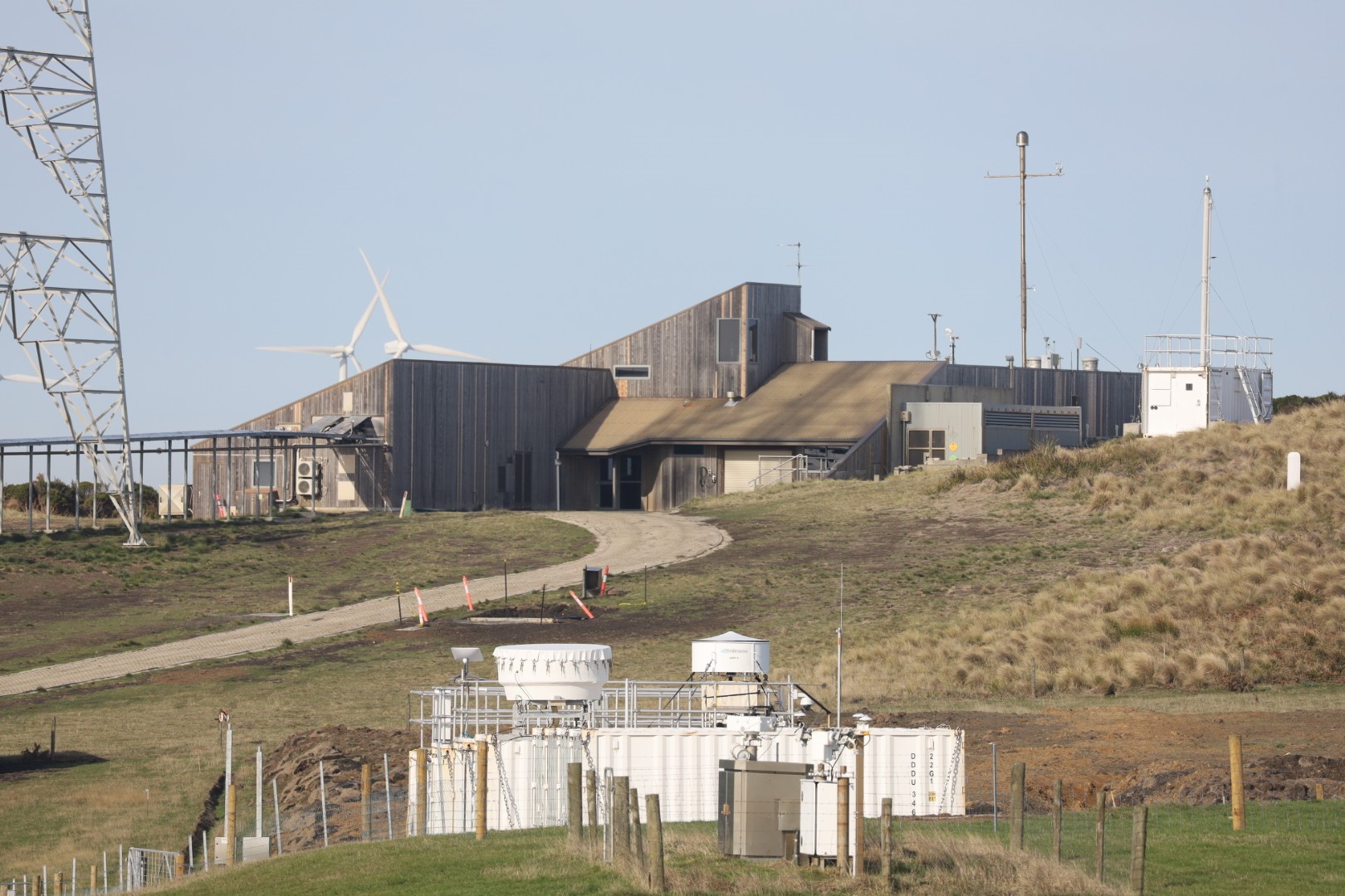
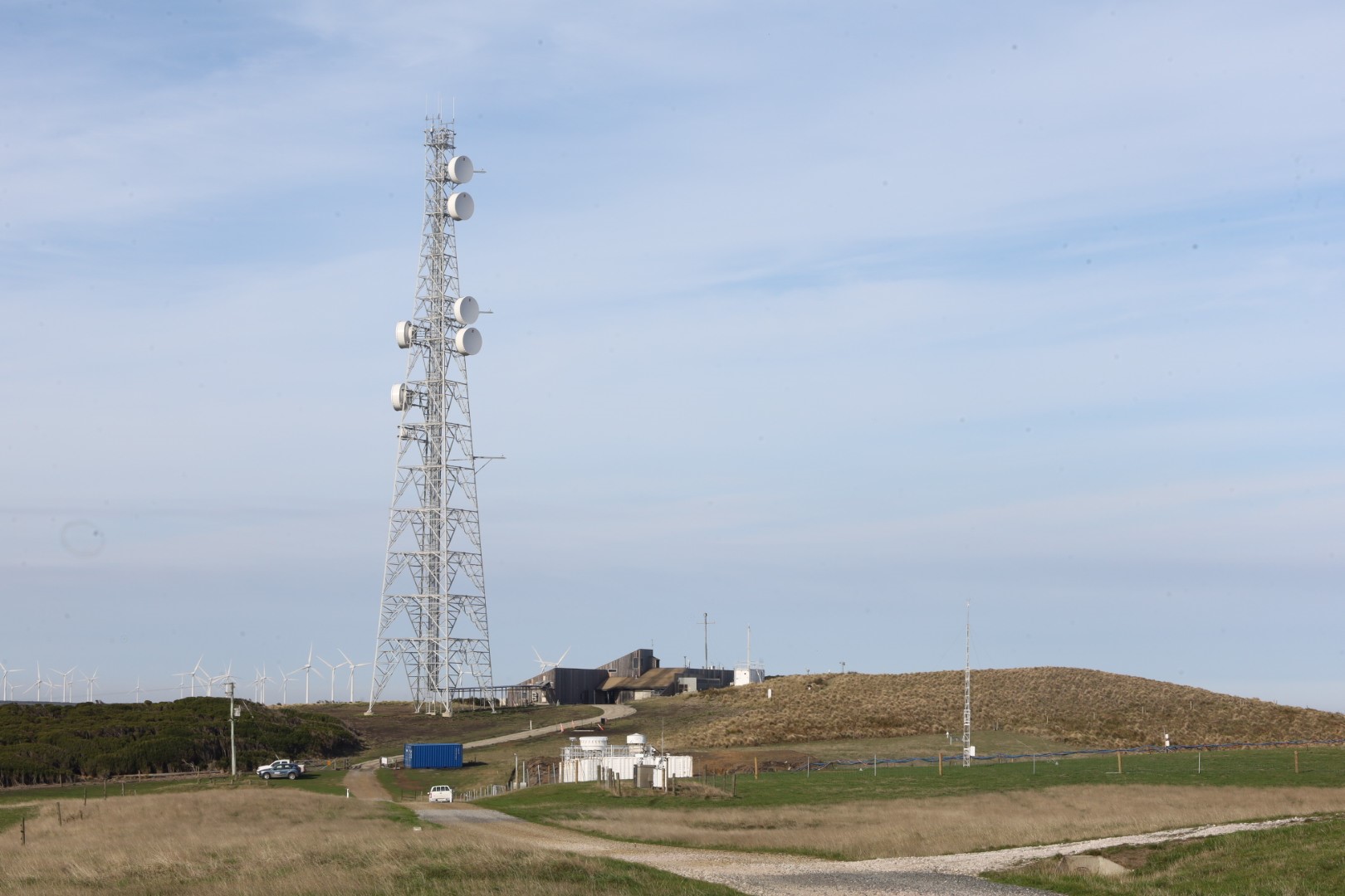
Called CAPE-k (Cloud And Precipitation Experiment at kennaook), the project will complement decades-long measurements taken at the Kennaook / Cape Grim Baseline Air Pollution Station.
CSIRO Senior Principal Research Scientist Dr Melita Keywood said these measurements will help address gaps in climate science around our understanding of cloud properties.
"New data will help explain what’s happening between the surface and the clouds, and what’s happening within the unique ‘super-cooled’ liquid clouds that are known to form in the region,” Dr Keywood said.
"These high-quality observations will help us to correct known biases in climate models, so that we have more accurate projections to understand Earth’s changing climate into the future.
"Knowing approximately how much sunlight is reflected back to space over the Southern Ocean, an influential part of our global climate system, will help better understand how much heat is trapped in Earth’s atmosphere.
“With Earth just recording its hottest year on record, better quantifying how much heat is trapped in Earth’s atmosphere has never been so important.”
Department of Energy ARM Program Manager, Dr Sally McFarlane, said the CAPE-k project will provide important information on aerosol-cloud-precipitation interactions to help reduce a large source of uncertainty in current climate models.
“The Kennaook / Cape Grim Baseline Air Pollution Station is an ideal location for this study due to its extensive long-term record of aerosol and gas-phase chemistry measurements and its unique location, which results in frequent sampling of pristine air masses from the Southern Ocean.”
ARM CAPE-k lead scientist Dr Gerald (Jay) Mace said current climate models struggle to simulate clouds over the Southern Ocean, resulting in a blind spot for the international climate science community.
"One of the key issues is that climate models assume that the Southern Ocean has the same amount of ice nucleating aerosol particles as the rest of the world’s oceans, meaning they predict that too much sunlight reaches the ocean," Dr Mace said.
“The collaboration with CSIRO and the Bureau of Meteorology will enable us to address these knowledge gaps and tie everything together, to get all the seasons, and to take advantage of the long-term atmospheric record at this location spanning back to 1976.
"We are excited about the knowledge around aerosols and clouds in this region that these high-quality observations will unlock for the climate science community.”
The Kennaook / Cape Grim Baseline Air Pollution Station is jointly managed by the Bureau of Meteorology and CSIRO.
Bureau of Meteorology Station Manager Sarah Prior said the site has played an important role in global atmospheric observations since 1976.
"The station's location means that, for much of the year, air samples taken are considered "baseline" because the wind originates over vast, uninterrupted stretches of ocean, and is hence representative of a large part of the Southern Hemisphere," Ms Prior said.
“Baseline air provides important data on greenhouse gases and other substances like chlorofluorocarbons (CFCs) in the atmosphere.
"Air is continuously measured 24 hours a day from inlets up to 80 metres above the station.
"The inlet pipes allow outside air to flow into the station where instruments analyse in real-time a range of atmospheric compounds to track the drivers of climate change and ozone depletion.
"We're thrilled to be able to add to this work by hosting the CAPE-k campaign at the site."
The project will run from April 2024 to September 2025.
ENDS
Note to Editors: kennaook is lowercased in the project acronym’s full name, and the k is lowercased in the acronym to honour aboriginal practices in lutruwita / Tasmania.
Kennaook is capitalised when referring to the place name.
When writing the dual name, please use a spaced forward slash to separate the two parts of the name.
About Kennaook / Cape Grim Baseline Air Pollution Station
The Kennaook / Cape Grim Baseline Air Pollution Station is a joint responsibility of the Bureau of Meteorology and the Commonwealth Scientific and Industrial Research Organisation (CSIRO). The Bureau of Meteorology funds and operates the facility. CSIRO analyses and models the data, which is made available to Australian government agencies, industry, the public and international agencies.
The station first began measuring the composition of the atmosphere in April 1976 and has been in continuous operation ever since.
The Baseline Air Archive dates back to 1978 with tanks shipped and stored safely at the CSIRO Aspendale atmospheric research lab for future research.
Kennaook / Cape Grim is considered one of three premier global stations in the World Meteorological Organization's (WMO) Global Atmospheric Watch programme. Its premier status is due to the length of the data record (47 years) and range of chemical species collected. The site was chosen due to its unique position on the planet. It's located in the roaring forties (mariner's nickname used to describe strong westerly winds that circulate the Southern Ocean around the 40 degrees south latitudinal band).
About U.S. Department of Energy Atmospheric Radiation Measurement (ARM) user facility
ARM is a DOE Office of Science user facility operated by nine DOE national laboratories. ARM has more than 30 years of atmospheric data, freely available from all 7 continents and 5 oceans.
About aerosols
Aerosols play a vital role in the formation of clouds by acting as nuclei for water to condense onto and then form clouds. The source of aerosol particles, and their distribution, affects how and where clouds form, whether they exist as super-cooled liquid or ice, and how much moisture they can release via precipitation (rainfall). The complex interactions between aerosols and clouds remain an active area of research for the international science community.
The main aerosols found in the Southern Ocean region are derived from sea spray or gases released by phytoplankton.
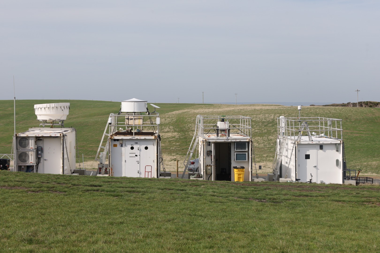
About key CAPE-k instrumentation:
- The Ka-Band ARM Zenith Radar allows researchers to study cloud dynamics by remotely probing the extent and composition of clouds at millimetre wavelengths. The upward-pointing radar determines reflectivity, vertical velocity, and spectral width from near the ground to nearly 20 kilometres in altitude.
- Microwave radiometers measure the thermal energy of the atmosphere, providing information about the water vapor and liquid water content.
- The micropulse lidar is designed primarily to determine the altitude of clouds, but it is also used to detect atmospheric particles. The lidar sends pulses of energy into the atmosphere, and the energy scattered back to the transceiver is collected and measured as a time-resolved signal, thereby detecting clouds and atmospheric particles in real time.
- The ceilometer measures cloud height, vertical visibility, and potential backscatter signals by atmospheric particles. It also detects up to three cloud layers simultaneously.
- Throughout CAPE-k, ARM will launch weather balloons with radiosondes attached to measure temperature, pressure, humidity, and wind. During most of the campaign, an automated radiosonde launcher on loan from the Bureau of Meteorology will send up radiosondes twice a day. There will also be periods when ARM increases the number of launches—up to eight times per day—to collect data in baseline air conditions.
- Cloud condensation nuclei counters at the Kennaook / Cape Grim Baseline Air Pollution Station measure the count and size of individual particles that can form into cloud droplets.